Data visualisation
History
Maps are the earliest form of data visualization. The history of cartography starts in 2300 BC with Babylon clay tablets depicting parts of the world. From 350 BC on maps became preciser when the Greek came to the conclusion the earth is round and started to draw forerunners of meridians on their maps.
Data visualization outside of cartography started in Egypt around 200 BC. with tables to organize astronomical information to become suitable for navigation.
Charts are invented in the 17th century by 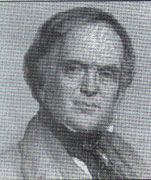 Descartes, who was a mathematician when he wasn’t philosophizing. He used it for calculations but later on people recognized they could be useful for illustrating numbers in a clear matter.
William Playfair introduced among more the bar charts and pie charts. He used them all his ‘commercial and political atlas’ from 1786 and now we cannot imagine an atlas without graphs and diagrams.
The American statistic John Tukey was one of the further founders of data analyzing in the seventies, 
 followed by Edward Tufte in the eighties. After this statistics are integrated in the business world and anyone with a computer can make his own graphs en tables without thinking twice
Albert Bartlett
Mr. Bartlett would like us to think twice about how numbers are integrated in our daily lives, the way facts are presented to us and how easily we can be misled.
He gives lectures about the importance of understanding the exponential (“The greatest shortcoming of the human race is our inability to understand the exponential function”). The subjects he speaks of are still recent, about problems caused by the worldwide speed of population growth.
What we are told in his talk is that we should be more easily get worried about growth percentages. He gives examples from the seventies about the duration of our oil supply. People were told by companies; there will always be enough fossil fuel because we will always find new sources. When that seemed nonsensical  the replacement estimation of 1975 was that based on the fuel use of that year, we could last another 500 years. Ignoring in this calculation the enormous growth of energy use every year, therefor being completely inaccurate as well. The lecture is on youtube under the title; ‘the most important video you’ll ever see’.
Eric Fischer
To bring some art in this article I bring you Eric Fischer,  an artist who combines his interest in society and statistics into different works about life and tourism in cities.
Eric Fischer combines information of different websites with his own social questions, rustling in colorful maps of cities that tell a story about its inhabitants and visitors. In his project ‘Locals and Tourists’ he researches the difference in locations of where the locals and visitors take their pictures in town. In the project ‘Race and Ethnicity’ he displays on which places people of different origins live, and at first glance you see groups stick together in neighborhoods.
Final Note
What Albert Bartlett and Eric Fischer both do is combine their expertise and interest for human behavior into a form they then communicate to the rest of the world, trying to get their view across. Albert Bartlett is very literal in pointing towards problems and Eric Fischer’s works are also in your face obvious, but neither bring us an answer. Data visualization doesn’t provide with answers anyway; it is neutral and it’s up to the viewer to do something with it as did the Egyptians 2300 years ago I mentioned; navigate.
