
Gaspar Felix Tournachon was the first man who took to the sky with a camera and a balloon around 1855. Since then there have been remarkable advances in aerial photography such as the use of kites and even pigeons. The idea: let’s make photos from the sky. But the simplest of ideas can evolve to have great consequences and impact on design, science, war, life and perceiving our world.
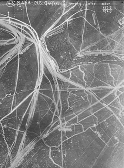
The first Photos taken from the sky were regarded as art. Later the combination of revolutionary technologies were used for map making and surveying. Aerial photography became, like many other advances in technology, big in times of war. During the First World War photos were taken from the sky for mapping and scouting areas of battle. The leap of technical improvements made by the army where appreciated in the scientific world. Scientists were now using aerial photography to develop concepts and ways of thinking. Another contribution to science was the possibility to minizalise field research. However, one problem applied itself: conclusions needed to be drawn from a complex play of lines, surfaces and (black and white) tones. Therefore the interpretation of aerial footage demanded a great deal of knowledge and experience.
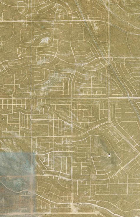
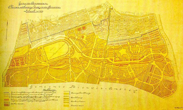
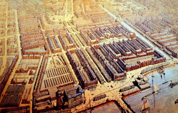
Nowadays we can discover phenomena our selves, for example; patterns in our surroundings become clearer. A distinction can be made between natural phenomena and cultural choices [x]. If we direct the eye of the camera to our own neighborhood (Amsterdam Zuid), we can see the choices the architects made regarding the public space. H.P. Berlage was subject to the movement Amsterdamse School and architect of “Plan Zuid”. He had two initial designs: one shown as a map and one as an illustration of an aerial photo. Both of these images were a result of the early aerial photography and are used in the way it was supposed to be used; as the clear view from the eye of a bird. It enables the viewer to become a distant observer and things fall in to place. But as big as your surrounding looks from the ground up, as small it is looking down. The photo shows a miniature reality; in this case we can compare it with a 2D maquette. This phenomenon is not different from the rest of photography; a photo manipulates the scale of the world, it is only a representation of reality.
My generation takes these “photos without legs” for granted, but if we stop to think, we could imagine our environment from above, which creates a new dimension. Just how our vision was once aimed up we can now look down. We could say the upwards vision is one of imagination, where as the downwards vision is one of reflection.
Because of the digital revolution, images from above are now widely available for everyone. Susan Sontag states in her book on photography “collecting images is collecting the world”. This is completely true regarding aerial photography. We could say that the final frontier in aerial photography has been reached by Google earth, where the sky is not the limit anymore. Google Earth is the collection of images from the world; everything is visible for everyone. However, it is again merely a representation. An aerial picture, like any other, is subjected to an element of coincidence.

Pictures are dependent on external factors like the weather. Our globe is a sunny one, according to Google: not a cloud in the sky. You could ask yourself what, or who, is looking at us from above? Without, of course, getting into a religious discussion; I’m not referring to that. Nowadays photographing from above is taken over by machines; the photographer is cut out of the equation. Or, the role of the photographer has changed into making a collage based on lines, surfaces and (color)tones.
Through the centuries scientists, artists and, not unimportantly, the army have never stopped using aerial photography and there are still a lot of innovations taking place. In the scientifical field there is now a development called “remote sensing” which allows the researcher to take the light reflecting surfaces in different wavelengths in account. Infra red, for example, is a good way of distinguishing vegetation. Richard Mosse is a photographer who uses these infra red effects. The army also keeps on designing new ways of using the sky. An example of this are the predator drones. Be it in design, art, science or war; aerial photography has changed our way of perceiving the world and has a function in daily life.